
B.C. Wildfire Service says crews are making progress on destructive fires in Shuswap and Okanagan
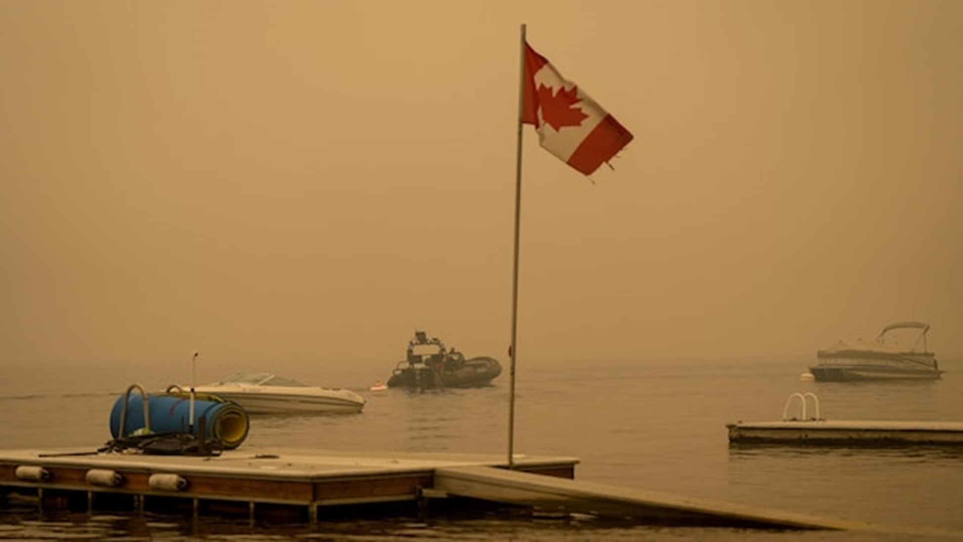
- Smoke is blanketing much of the province, prompting air quality advisories and special weather statements.
- A provincewide state of emergency is in place in B.C. Here’s what it means (new window).
- Non-essential travel to the southern Interior has been restricted (new window) as 30,000 people are under evacuation orders, around a third of them in the Kelowna area.
- Homes have been destroyed and more than 4,000 properties are on evacuation order (new window) in the Shuswap region, as two major fires combined near Adams Lake.
- The B.C. Wildfire Service says critical equipment has been taken (new window) from the area.
- Highway 1 remains closed and evacuation orders are still in place in the Fraser Canyon as a result of the Kookipi Creek wildfire (new window).
- Many people want to help evacuees. Learn more about how to offer your support (new window).
- Find a full list of wildfires, highway closures and evacuation orders and alerts (new window).
- Tune in for ongoing coverage of the wildfire situation on CBC Radio One at 88.9 FM in Kelowna, 96.9 FM in Salmon Arm, or by using the CBC Listen app (new window). (new window) You can also watch free livestreams on CBC News Network (new window) and CBC Gem (new window).
As the southern quarter of British Columbia is warned about the risk of particulates in the air from wildfire smoke, those battling blazes in the Central Okanagan say the smoke is helping their cause.
A special air quality statement and smoky skies bulletin (new window) is in place from Vancouver Island east to the Alberta border, as well as in the central Interior, due to smoke from hundreds of wildfires burning across the province.
An additional air quality advisory (new window) remains in place for Metro Vancouver and the Fraser Valley, warning of high concentrations of fine particulate matter in the air.
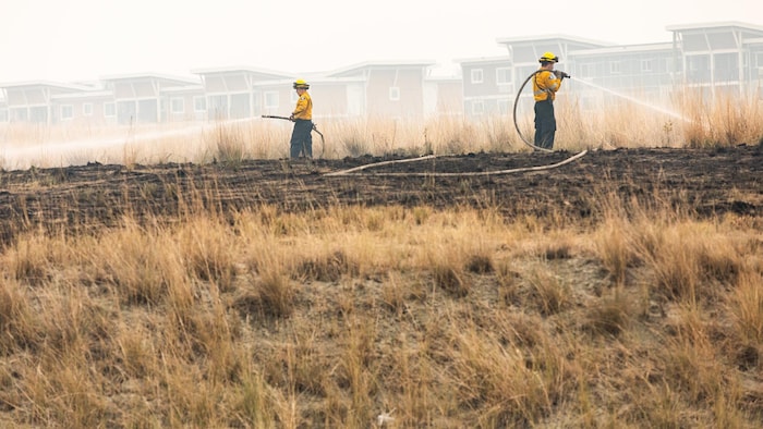
While the amount of smoke in the air has created harmful conditions for people’s health, it’s also reducing the sun’s intensity, which is helping the fight against wildfires, crews in B.C.’s Interior say.
Yesterday was the first day where we actually felt like we were moving forward instead of moving backward, and that’s continued,
said West Kelowna Fire Chief Jason Brolund on Monday morning.
Crews have been able to put out hot spots and create guards around homes in his community, and also in neighbouring Kelowna.
Brolund said a process is now in place for officials to better assess the amount of damage the McDougall Creek wildfire (new window) has caused. It’s now 110 square kilometres in size and still burning out of control.
Once the damage assessment is completed, residents can be notified and utilities can be restored to homes that remain. After that, Brolund said, re-entry to the area would be possible.
He didn’t provide any timelines but said he was optimistic.
FIRE CREWS ‘MOVING FORWARD’ AGAINST BLAZES NEAR KELOWNA
Cooler temperatures helped firefighters make progress against wildfires in the Kelowna area after a volatile few days. Meanwhile, the blazes have put a major pause on the area’s tourism industry.
So far there is no official count of how many homes have been destroyed in B.C. since fire activity dramatically accelerated last week, but officials have acknowledged damage is significant.
There are more than 380 active wildfires burning across B.C. as of early Monday, fuelled by wind, drought and hot weather that have left landscapes tinder dry.
Of those fires, 157 are deemed out of control while 14 are categorized as fires of note, meaning they are particularly visible or threatening to property.
An unknown number of homes have also been destroyed in the Shuswap region east of Kamloops, where the Bush Creek East fire (new window) is now burning over 410 square kilometres around Adams Lake and Shuswap Lake.
In a long string of posts on X (new window), formerly known as Twitter, the B.C. Wildfire Service said late Sunday that firefighters had made good progress on fires in the Shuswap.
The Central Okanagan Emergency Operations Centre is expected to provide an update on the wildfire situation in the region at 10 a.m. PT Monday.
Travel restrictions, advisories
The province is under a state of emergency, and travel to B.C.’s southern Interior has been restricted (new window), preventing tourists from using hotels, motels, RV parks and other temporary accommodations in Kelowna and West Kelowna, Kamloops, Oliver, Osoyoos, Penticton and Vernon, so they can be utilized for evacuees.
Wildfires are also affecting several travel corridors through B.C. Highway 1 is closed in at least two spots: between Lytton and Hope in the Fraser Canyon, and between Chase and Sorrento in the Shuswap.
Other travel advisories:
- Highway 97, in both directions, just south of Coldstream to Peachland.
- Highway 97, in both directions, six kilometres north of Vernon to three kilometres south of Osoyoos.
- Highway 5A, in both directions, between Old Kamloops Road and Roche Lake Road for 13 kilometres south of Kamloops.
DriveBC (new window) has a full listing of all road closures and travel advisories.