A building ridge could allow the country to see its first 40-degree reading of the year by Monday afternoon
A few places have come perilously close to the symbolic 40-degree mark this summer, but nobody in Canada has seen this symbolic heat milestone so far in 2023.
Monday could end that streak.
We’re watching a formidable ridge building over Western Canada heading into next week, which could allow some communities to close in on an elusive 40°C reading.
RELATED: Why extreme heat is one of the world’s deadliest weather disasters
Building ridge looms over the West Coast
A hefty upper-level ridge will build southwest of Vancouver Island to end the weekend. Ridges are harbingers of above-seasonal temperatures because they foster sinking air, which warms up as it descends toward the ground.
Sunday will see temperatures soar well above seasonal for much of British Columbia as a result of this building ridge. Widespread heat warnings are in effect throughout portions of Vancouver Island, the South Coast, and east toward the Interior.
What looks to make this spell of hot weather unusual is that it won’t exactly be a dry heat. We’ll see some Pacific moisture lingering in the region as temperatures climb, which will make it feel unusually muggy for the duration of this heat event.
DON’T MISS: Canada’s historic wildfire season only halfway done: A checkpoint
The dew point here rarely climbs above 15°C during the summertime, but we could see dew point readings close to 20°C for some coastal communities by Monday. That’s the kind of uncomfortable humidity you’d expect to see on a sultry summer afternoon back east.
This setup is a tradeoff between simmering mugginess and searing heat. Folks along the immediate coast will have cooler temperatures but higher humidity, while communities farther inland will see hotter but less-muggy conditions.
Unfortunately, the Fraser Valley and Lower Mainland will be an exception to this pattern, as forecasters expect low-level moisture to pool in these areas, contributing to elevated humidex values.
Canada’s first 40°C of 2023 is almost here
Hot temperatures will arrive in earnest by Monday, ticking a few degrees warmer than what we saw on Sunday. These temperatures will be downright uncomfortable for most, and even dangerous heat for vulnerable populations throughout the region.
Daytime highs will climb into the upper 20s to near 30°C right along the coast, with the mid-30s likely as you travel inland up the Fraser.
It’s across the typical hotspots like Osoyoos and communities throughout the southern Interior where we stand a chance to record the country’s first 40-degree reading of the year.

Stay safe in the heat
Hot temperatures are the most dangerous weather you’re likely to face during the summer months. It’s a silent hazard that can sneak up on even the fittest individuals.
RELATED: How hot is too hot for the human body?
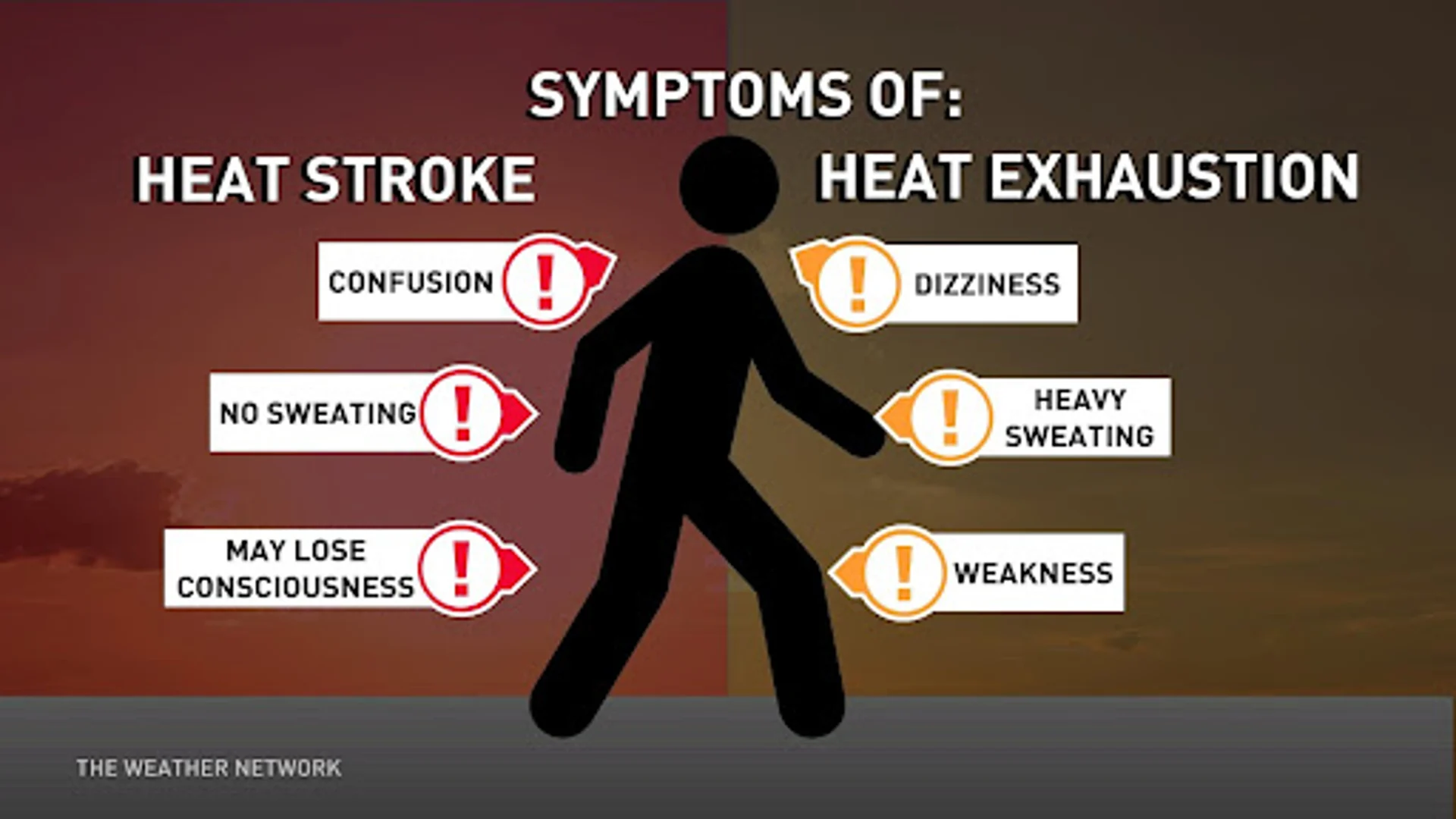
Use caution if you have to spend extended periods of time outdoors during the day. Stay aware of the symptoms of heat exhaustion and heat stroke, staying hydrated and taking frequent cooling breaks to prevent illness. Humidity will make it harder for the body to cool off during the heat of the day, and the muggy air will subdue any relief overnight


